Revolutionizing modern photography, GPS-enabled digital cameras seamlessly merge precise location data with your creative vision, transforming how we capture and organize our visual stories. Every image becomes a data-rich artifact, automatically tagged with exact coordinates, elevation, and even the direction you were facing when you pressed the shutter. This technology has become indispensable for professional photographers documenting assignments, travel enthusiasts creating detailed photo journals, and researchers requiring precise location records of their visual data.
Beyond simple location tagging, camera GPS systems now integrate with sophisticated mapping software, enabling photographers to retrace their shooting routes, discover popular photo spots, and create compelling location-based storytelling through their images. Whether you’re navigating remote landscapes, documenting wildlife habitats, or simply wanting to remember exactly where you captured that perfect sunset, GPS functionality has evolved from a luxury feature to an essential tool in modern digital photography.
This powerful combination of visual artistry and geospatial precision opens up new possibilities for both creative expression and practical applications, from geotagged portfolios to location-based image organization systems that transform how we manage and share our photographic adventures.
How GPS Works in Digital Cameras
Built-in vs External GPS Units
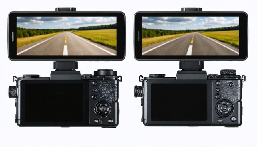
When it comes to GPS functionality in digital cameras, you have two main options: built-in GPS units and external GPS receivers. Built-in GPS modules offer seamless integration and convenience, eliminating the need for additional equipment. However, they can drain your camera’s battery faster and may add to the overall cost of the camera – something to consider as you protect your camera investment.
External GPS units, while requiring separate handling and connection, often provide more accurate location data and don’t impact your camera’s battery life. They’re also more flexible since you can upgrade them independently of your camera body and use them with multiple devices. Some photographers prefer external units for their superior signal reception, especially in challenging environments like dense urban areas or under heavy tree cover.
The choice between built-in and external GPS largely depends on your shooting style. If you prioritize convenience and seamless operation, built-in GPS might be your best bet. However, if precision and flexibility are more important, an external unit could be worth the extra effort of carrying and managing a separate device.
GPS Tagging Accuracy and Limitations
While GPS tagging in digital cameras can significantly enhance your photography workflow, it’s important to understand its limitations and accuracy factors. Most camera GPS systems are accurate within 10-50 meters, depending on various conditions. This precision level is usually sufficient for general location tracking but might not pinpoint exact shooting spots in dense urban areas or narrow streets.
Several factors can affect GPS accuracy in cameras. Tall buildings, dense foliage, and indoor locations can weaken or block satellite signals, leading to incorrect location data or failed tagging altogether. Weather conditions, particularly heavy cloud cover, may also impact GPS performance. Additionally, the initial GPS lock can take anywhere from a few seconds to several minutes, potentially missing location data for your first few shots in a new location.
Battery consumption is another consideration, as active GPS tracking can significantly reduce your camera’s operating time. Some cameras address this by offering intermittent GPS logging or smartphone connectivity options that consume less power while maintaining reasonable accuracy. To maximize accuracy, it’s recommended to allow your camera time to establish a strong GPS signal before beginning your shoot, particularly in new locations.
Software Integration Benefits
Photo Organization by Location
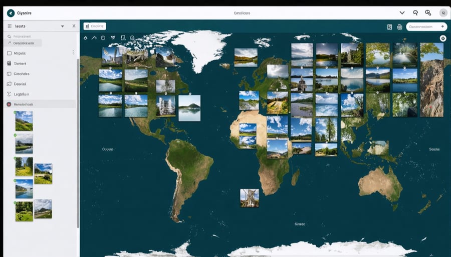
One of the most powerful features of GPS-enabled cameras is their ability to automatically organize photos by location. When you streamline your photo workflow, location data becomes an invaluable organizing tool, automatically creating a virtual map of your photographic journey.
Modern photo management software can read the GPS coordinates embedded in your images’ metadata and sort them into location-based collections. Imagine returning from a European vacation with thousands of photos – instead of manually sorting through them, your software can instantly group images by country, city, and even specific landmarks. Photos taken at the Eiffel Tower will automatically cluster together, separate from those captured at the Colosseum.
This location-based organization extends beyond just sorting. Many applications create interactive maps of your photo locations, allowing you to visualize your photography adventures and quickly find specific shots. You can filter images by region, create location-based albums, or generate travel routes from your photo metadata.
The system also helps with keywording and tagging. Software can automatically add location-specific tags to your images, making them easily searchable. Whether you’re looking for all your beach photos from Hawaii or every shot you’ve taken in New York City, GPS data makes finding specific images remarkably simple and efficient.
Map Integration Features
Modern photo management software has revolutionized how we organize and visualize our GPS-tagged images. Adobe Lightroom stands out as a leading solution, offering a robust Map module that lets photographers plot their images on an interactive world map and create location-based collections. You can easily view where each photo was taken, track photography trips, and even reverse geocode locations to add detailed place names to your metadata.
Google Earth Pro takes mapping integration a step further, allowing photographers to create virtual tours of their shooting locations and visualize their photographic journey in 3D. The software can read GPS coordinates directly from your images’ EXIF data and create custom placemarks with embedded photo thumbnails.
For mobile workflows, apps like Mapify and Really Good Photo Map have gained popularity among travel photographers. These apps create beautiful visual stories by combining your photos with route tracking and custom map styles. They’re particularly useful for adventure photographers who want to share both their images and the journey behind them.
Photography-specific platforms like Flickr and 500px also incorporate mapping features, displaying photo locations on interactive maps and allowing users to discover images based on geographic regions. This integration helps photographers connect with local photography communities and find inspiring shooting locations in unfamiliar areas.
Popular Software Solutions
Desktop Applications
Desktop applications have revolutionized how photographers manage and organize their GPS-tagged images. Adobe Lightroom stands out as the industry standard, offering robust GPS functionality through its Map module. This powerful feature allows photographers to visualize their photo locations on an interactive map, create location-based collections, and even reverse geocode images to add location details automatically.
Capture One has also embraced GPS integration, though in a more streamlined fashion. While it doesn’t offer the extensive mapping features of Lightroom, it excellently preserves and displays GPS metadata, making it an integral part of your photo backup workflow.
For those seeking dedicated GPS management, applications like GPicSync and GeoSetter offer specialized tools for adding GPS data to photos after capture. These programs are particularly useful for photographers using cameras without built-in GPS or when working with older images that lack location information.
What sets these desktop solutions apart is their ability to batch process hundreds of images at once. Whether you’re organizing a travel photography portfolio or documenting location scouts, these applications can automatically sort images by location, create interactive maps for clients, or generate location-based keywords for better searchability.
Many of these applications also support GPS track logs, allowing photographers to match their images with recorded GPS paths even when the camera lacks GPS capabilities. This feature is especially valuable for adventure photographers and documentary work where precise location tracking is essential.
Mobile Apps and Cloud Services
The rise of smartphone apps and cloud services has revolutionized how photographers manage GPS-tagged images. Popular apps like Lightroom Mobile, Google Photos, and Apple Photos automatically organize photos by location, creating interactive maps of your photographic journey. These platforms seamlessly integrate with your camera’s GPS data, making it easier than ever to catalog and discover images based on where they were taken.
For photographers prioritizing efficient digital photo storage, services like Adobe Creative Cloud and Google Drive offer automatic GPS data preservation when uploading images. This ensures your location metadata remains intact while providing backup security.
Specialized apps like Geotag Photos Pro and GPS4Cam Pro offer solutions for cameras without built-in GPS. These apps record your location data separately, which can be synchronized with your photos later. Some even allow you to create custom maps of your photography locations and share them with clients or fellow photographers.
Many modern cloud platforms also feature advanced location-based search capabilities. Want to find all the photos you took in Yosemite last summer? Simply search the location, and the platform will display all images tagged in that area. This functionality is particularly valuable for travel photographers and anyone managing large image collections.
For professional photographers, services like PhotoShelter and SmugMug incorporate GPS data into their client delivery systems, allowing customers to browse images by location – a feature particularly useful for destination wedding and event photography.
Practical Applications
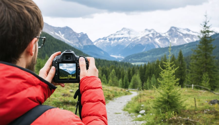
GPS-enabled digital cameras open up a world of practical possibilities for both amateur and professional photographers. One of the most valuable applications is automatic location tagging, which helps photographers maintain detailed records of where each shot was taken. This is particularly useful for travel photographers who might capture hundreds of images across multiple locations in a single day.
For landscape photographers, GPS data helps track specific shooting locations, making it easier to return to that perfect spot for different lighting conditions or seasons. Wildlife photographers can use GPS coordinates to document animal habitats and migration patterns, contributing valuable data to conservation efforts while maintaining accurate records of their encounters.
Real estate photographers benefit from automatic location tagging when shooting multiple properties in a day, ensuring accurate organization and client delivery. The GPS data can also be used to generate precise property maps and location-based virtual tours.
Travel bloggers and social media content creators can easily create location-based stories and map-based galleries of their adventures. The GPS data seamlessly integrates with popular photo management software, allowing for automatic organization by location and easy creation of photo maps.
For documentary and photojournalistic work, GPS data provides crucial verification of where and when images were captured, adding an extra layer of authenticity to the work. This feature has become increasingly important in an era where photo verification is essential.
Event photographers can use GPS data to organize multiple shoots across different venues, while hiking and outdoor photographers can use it to create detailed trip reports combining photos with exact trail locations.
GPS integration in digital cameras has revolutionized the way we capture and organize our photographic memories. By automatically tagging our images with precise location data, this technology has simplified photo organization, enhanced storytelling capabilities, and opened new creative possibilities for photographers of all skill levels.
As we look to the future, GPS functionality in cameras continues to evolve. Advanced features like real-time location tracking, automated location-based camera settings, and seamless integration with mapping applications are becoming increasingly common. The rise of AI-powered photo management systems, combined with GPS data, promises even more sophisticated ways to catalog and search our photo collections.
For professional photographers, GPS capabilities have become an essential tool for location scouting, client work documentation, and precise return visits to shooting locations. Meanwhile, enthusiasts and travelers benefit from the ability to create detailed photo maps and share their adventures with pinpoint accuracy.
The marriage of photography and GPS technology represents more than just a convenient feature – it’s a fundamental shift in how we document and share our visual experiences. As camera technology continues to advance, we can expect GPS integration to become even more sophisticated, offering photographers new and innovative ways to enhance their craft.