 By
By 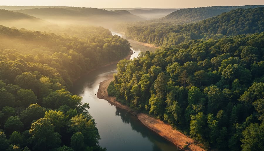
Capturing stunning aerial images in natural landscapes comes down to three essentials: choosing the right drone for rugged conditions, mastering compositional techniques that leverage elevation and perspective, and navigating the safety and regulatory challenges unique to wilderness environments. Nature offers drone photographers unparalleled opportunities that urban settings simply can’t match, dramatic topography, dynamic lighting across vast spaces, and the ability to reveal patterns and relationships invisible from the ground.
The appeal is straightforward. A forest canopy from above transforms into an abstract texture study. A winding river becomes a silvery ribbon threading through valleys. Coastal cliffs reveal geological layers that hikers never see. But shooting in these environments demands more than pointing your drone skyward and hoping for the best.
Weather shifts faster in open landscapes. You’re often miles from shelter when wind speeds spike or fog rolls in. Wildlife regulations restrict where and when you can fly. Battery life becomes critical when you’re far from a charging source. And the very remoteness that makes natural settings so photogenic also means a crash or malfunction can end your shoot immediately.
This guide walks through the practical realities of drone photography in nature, from selecting gear that handles temperature extremes and rough launches to framing compositions that do justice to epic scenery. You’ll learn how to scout locations efficiently, work within legal boundaries, and return home with images that capture the scale and beauty of the wild places you’ve flown.
What Makes Natural Landscapes Perfect for Drone Photography
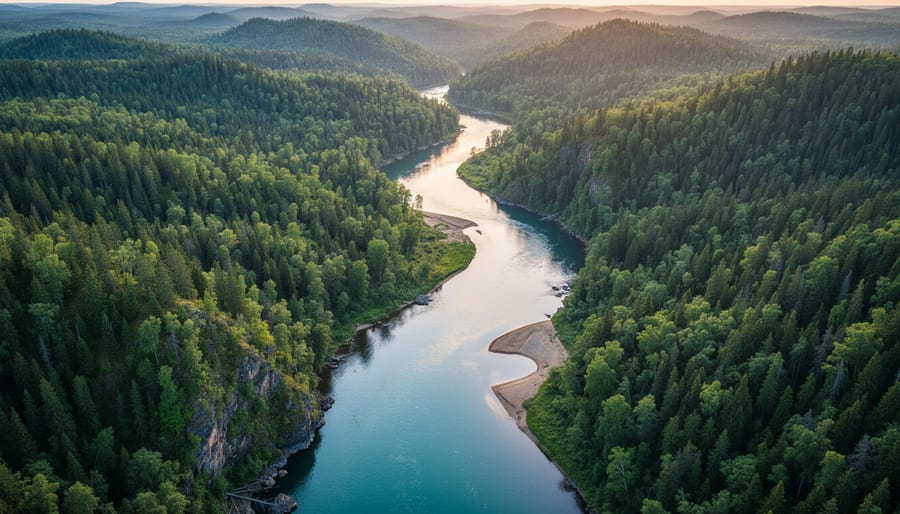
Natural landscapes don’t just accommodate drone photography, they’re designed for it. While urban environments force you to navigate around power lines, negotiate building permits, and compete with visual noise, nature offers open skies, unobstructed flight paths, and compositions that haven’t been photographed a thousand times from the same angle.
The real advantage comes from terrain variation. Mountains create dramatic elevation changes that add depth to your images. River valleys provide natural leading lines that pull viewers through the frame. Forests reveal patterns from above that remain completely invisible at ground level, the kind of geometric arrangements and color gradients that make people stop scrolling. These aren’t happy accidents; altitude transforms ordinary landscapes into abstract compositions.
Natural light behaves differently over wilderness. Without concrete and glass reflecting and diffusing sunlight, you get cleaner shadows and more dramatic contrast during golden hour. Atmospheric conditions that would ruin city shots, morning fog, storm clouds gathering over distant peaks, become the main subject in nature photography. The same weather system that sends urban drone pilots packing gives you three different lighting scenarios in an hour.
Seasonal changes multiply your creative possibilities from a single location. That autumn forest you photographed in October transforms into a minimalist study of branch patterns by December, then explodes with spring greens in April. Urban landscapes look largely the same year-round, but nature rewrites the scene every few months.
Perhaps most importantly, natural environments lack the visual clutter that plagues city aerials. No traffic cones, construction sites, or advertising billboards competing for attention. When you apply quadcopter landscape tips in wilderness settings, every element in your frame serves the composition rather than fighting against it. The result is cleaner, more impactful images that showcase what aerial perspective can actually do.
Essential Gear Considerations for Nature Drone Photography
Why Flight Time Becomes Critical in Remote Locations
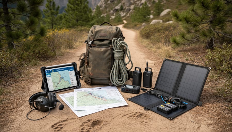
When you’re hiking two hours into the backcountry to shoot a waterfall at dawn, battery management becomes make-or-break. Cold temperatures alone can cut your flight time by 30%, and that gorgeous alpine lake you climbed 1,500 feet to reach won’t wait around while you hike back to your car for a fresh battery.
The math gets brutal fast. If your drone promises 25 minutes of flight time, factor in 20 minutes maximum in real-world conditions. Now subtract time for takeoff, landing, and repositioning. You’re looking at maybe three serious shooting attempts before you’re grounded. Miss your shot because of poor planning, and you’ve wasted an entire day.
Pack at least three fully charged batteries for any remote location. Keep them warm against your body during the hike, a battery pulled from an insulated pocket will perform far better than one stored in your cold camera bag. Before you fly, know exactly which shots you want. Walk the area, identify your compositions, then execute methodically. Every second of hovering while you figure out your framing burns precious power you can’t replace.
Filters That Actually Matter in Natural Light
Most drone pilots skip filters entirely, then wonder why their nature shots look washed out or why that gorgeous waterfall looks frozen in time instead of flowing smoothly.
Two filters actually earn their place in your kit for natural landscapes. An ND filter (neutral density) works like sunglasses for your camera, cutting light without changing colors. Think of it as the tool that lets you slow your shutter speed enough to create motion blur in moving water, swaying grass, or drifting clouds, the cinematic look that separates memorable footage from forgettable clips. Start with an ND16 for bright midday conditions.
A circular polarizing filter does something completely different: it cuts reflections and glare from water surfaces, wet rocks, and foliage. Point your drone toward water at a 90-degree angle from the sun, and a polarizer transforms murky reflections into transparent views of what lies beneath. It also deepens blue skies and makes clouds pop without touching a slider in post.
Here’s the catch: filters reduce light reaching your sensor, forcing longer exposures. That means they only work in decent lighting and calm winds. Fighting to keep your drone stable in gusts while using an ND32 creates blur you don’t want. Save filters for conditions that actually need them, not every flight.
Reading Natural Light Like a Landscape Photographer
The quality of light at 300 feet isn’t just different from ground level, it’s operating under completely different rules. When you’re shooting from above, you’re not just dealing with how light hits a subject; you’re working with light that’s interacting with entire landscapes, creating patterns and gradients that fundamentally change every few minutes.
Golden hour matters even more from altitude because you can capture the progression of light across vast areas in ways a ground-based photographer never sees. That warm, directional light doesn’t just illuminate a single tree, it sweeps across ridge lines, turns rivers into molten copper, and creates shadows that define topography invisible in midday sun. Position your drone so those long shadows reveal texture in terrain; a forest that looks like flat green carpet at noon becomes three-dimensional as those raking golden rays separate individual trees and reveal elevation changes.
Blue hour from above offers something ground shooters can’t access: the ability to balance twilight sky with reflected light in water bodies or snow while capturing both in a single frame. The diffused, even light eliminates harsh shadows but maintains enough color saturation to make natural features pop. Lakes and wetlands turn into mirrors during blue hour, doubling the impact of your composition when you frame them to include both sky and reflection.
But here’s what most drone pilots miss: altitude itself changes light quality in measurable ways. At 400 feet, you’re shooting through less atmospheric haze than someone on the ground, colors appear more saturated, contrast increases, and that golden glow intensifies. This works against you at midday when harsh light becomes even harsher, but it amplifies the magic during optimal conditions.
Dramatic weather turns into your creative ally from above. That approaching storm front creates lighting conditions that last minutes, not hours, dark, moody skies behind sunlit foreground elements, shafts of light breaking through clouds to spotlight specific features. The key is reading weather fast enough to fly safely while capturing these fleeting moments. Watch how light interacts with terrain rather than just pointing your camera at pretty clouds.
Compare your nature camera settings from ground-level to aerial work and you’ll notice you need faster shutter speeds to compensate for movement, even in what feels like calm air. The dynamic range challenges shift too, instead of managing a bright sky above dark forest floor, you’re balancing sunlit mountaintops against shadowed valleys, all in the same frame.
Composition Techniques That Work From Above
Finding Leading Lines in Nature
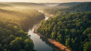
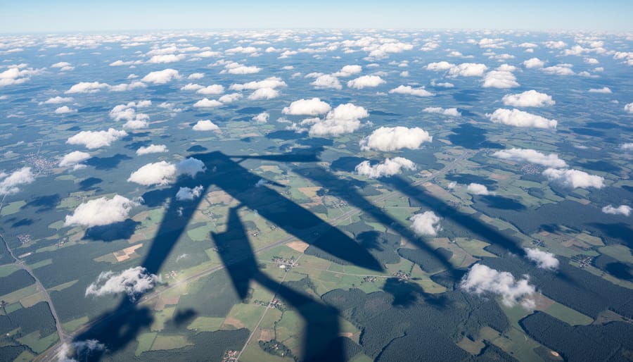
Rivers are nature’s gift to drone photographers, they naturally guide the viewer’s eye through your frame like nothing else can. From above, you’ll spot them instantly: winding through valleys, cutting across plains, or snaking through forests. Position your drone so the river enters from a corner and leads toward your main subject, whether that’s a mountain peak, a waterfall, or a distinctive bend.
Ridgelines work similarly but require more altitude to reveal their full power. Fly high enough to show how a mountain ridge creates a diagonal slash across your composition, separating forest from sky or valley from peak. These elevated lines add depth because they clearly show foreground, middle ground, and background.
Don’t overlook subtle lines, trails worn by deer or hikers, fence lines cutting through meadows, tree shadows at low sun, or even the edge where forest meets field. The principles of landscape composition apply from altitude, but you’ll see lines invisible from ground level. A dry creek bed barely noticeable when hiking becomes a dramatic diagonal from 200 feet up.
The key is recognizing that nature rarely draws straight lines. Embrace the curves, the meanders, the organic flow, they create more dynamic compositions than rigid geometry ever could.
The Power of Patterns and Textures
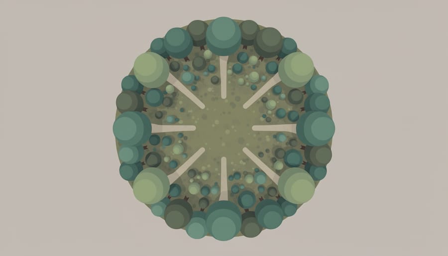
Altitude transforms chaotic landscapes into ordered compositions. That dense forest floor becomes a geometric tapestry of treetop circles. The random hillside reveals systematic erosion channels carving parallel grooves down its face. Your drone’s height compresses depth perception, flattening three-dimensional terrain into abstract patterns that our ground-based eyes simply can’t process.
Tree canopies work brilliantly around 80-120 feet, high enough to eliminate individual branch detail but low enough to preserve texture in the foliage. Too low and you’re shooting individual trees; too high and you lose the textural contrast that makes patterns compelling. Agricultural landscapes demand more altitude, often 250-400 feet, where crop rows create rhythmic lines that lead across the frame.
Look for repeating elements at different scales. A single weathered rock face might show fractal erosion patterns. A marshland could display repeating circular pond formations. The key is recognizing when nature’s repetition creates visual rhythm strong enough to carry the entire composition, without needing a traditional focal point or horizon line to anchor the viewer’s attention.
When to Break the Rules
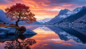
Sometimes the most striking aerial nature shots happen when you ignore everything you just learned about composition. A perfectly centered mountain reflected in a still alpine lake creates a powerful symmetry that would feel static in any other context, but from above, that mirror-perfect doubling becomes hypnotic. Dense forest canopies that seem like visual clutter from the ground transform into rich tapestries of texture when captured from 200 feet up, where the “mess” reveals surprising order in how trees compete for light.
Weather chaos often produces the best images. Storm clouds breaking apart over a valley, fog rolling through tree lines in uneven patches, or wind-whipped waves creating asymmetrical patterns across a bay, these moments of natural disorder carry an energy that tidy compositions can’t match. The key is recognizing when nature’s randomness tells a more honest story than forced balance.
Trust your instincts. If a cluttered scene full of competing elements makes you feel something visceral, that emotional response probably translates to the viewer. Not every image needs leading lines or rule-of-thirds placement. Sometimes nature simply demands that you point the camera and capture its beautiful mess exactly as it unfolds.
Navigating Safety and Legal Considerations
Flying your drone over a pristine lake or mountain ridge feels liberating until you realize you’re breaking regulations you didn’t know existed. National parks across North America ban recreational drone use entirely, yes, even if you’re just hovering 20 feet up for a quick shot. The rules exist to protect wildlife from stress and disturbance, and rangers actually enforce them. Before you launch anywhere, check local regulations through your aviation authority’s app and research specific restrictions for protected areas.
Wildlife disturbance isn’t abstract concern. Nesting birds will abandon eggs if repeatedly startled by drone noise. Elk and deer herds can panic and injure themselves fleeing from what they perceive as an aerial predator. Keep your distance, at least 100 yards from any animal group, and if they react to your drone’s presence, back off immediately. The shot isn’t worth disrupting their habitat or causing genuine harm.
Weather changes faster in natural areas than your forecast predicted. That gentle breeze at ground level becomes a 25mph gust at 200 feet, pushing your drone sideways and draining batteries twice as fast. I’ve watched clouds roll in within ten minutes, reducing visibility to nothing. Always check current conditions before launching, maintain visual line of sight, and land at the first sign of deteriorating weather rather than gambling on “just one more shot.”
Remote locations demand extra safety protocols that apply field-tested techniques from wilderness photography to aerial work. Tell someone your flight location and expected return time. Carry a fully charged phone with offline maps. Pack a basic first aid kit. When you’re two miles from the nearest road and your drone crashes into a tree, you’re genuinely on your own, prepare accordingly.
Working With Nature’s Unpredictability
Nature doesn’t follow your shooting schedule, and that’s exactly what makes it interesting. The conditions that frustrate beginners often create the most memorable images once you learn to work with them instead of against them.
Wind is your most common challenge in natural environments. If your drone struggles to hold position or you’re burning through batteries twice as fast as normal, it’s time to land. Gusts above 20 mph make precise framing nearly impossible and risk damaging your equipment. But moderate wind isn’t always your enemy, it animates grass, creates ripples across water, and adds movement to clouds that can elevate a static landscape into something dynamic.
Watch weather patterns, not just current conditions. That dark cloud bank approaching from the west will arrive faster than you think at altitude. I’ve learned to launch immediately when storms clear rather than waiting for “perfect” light, the dramatic cloud textures and saturated colors in the 30 minutes after rain often beat golden hour.
Wildlife deserves special consideration. If animals change behavior when you launch, birds flushing repeatedly, deer running, or nesting sites abandoned, you’re too close. Gain altitude quickly to minimize disturbance, and protect wildlife by keeping horizontal distance even when filming from above. During nesting seasons in spring, skip areas with visible nests entirely.
The best advice is simple: shoot when conditions are interesting, not perfect. Overcast skies eliminate harsh shadows. Light rain creates moody atmospheres. Even “bad” weather tells compelling stories about places that polished sunny shots cannot convey.
Post-Processing for Natural Drone Images
Start with exposure before anything else. Aerial shots often have blown-out skies or crushed shadows because you’re capturing a massive dynamic range from high above. Pull down highlights first to recover detail in clouds and bright water reflections, then lift shadows just enough to reveal texture in darker foliage or rock formations. Don’t go overboard, natural landscapes should retain contrast, not look like flat HDR nightmares.
For atmospheric haze, which shows up in nearly every drone shot above a certain altitude, use the dehaze slider sparingly. A little goes a long way. Too much makes skies look artificially dark and creates weird color shifts in distant mountains. If haze is thick, increase it just until distant elements regain definition, then stop. Sometimes a touch of extra clarity helps, but it can also emphasize noise and make tree canopies look crunchy, so zoom to 100% and check before committing.
Color grading natural drone images means working with what’s already there, not inventing drama. Reduce vibrance if greens look radioactive, and adjust individual color channels rather than cranking saturation globally. Shift greens slightly toward yellow for autumn warmth, or toward cyan for cooler forest tones. Water often photographs too cyan, add warmth or shift blues toward a more natural teal. The goal is making colors feel richer without crossing into fantasy.
Lens distortion correction matters more than you’d think. Most drone cameras have slight barrel distortion that bends horizons and warps forest edges. Enable profile corrections if your editing software recognizes your drone model. If not, manually adjust distortion until straight lines like ridgelines and lake shores actually look straight.
Finally, check your whites and blacks by holding Alt while adjusting sliders. This reveals clipping you might miss otherwise. Natural landscapes have detail everywhere, blown highlights in sun-drenched meadows or blocked-up shadows in canyon depths both kill the sense of depth that makes aerial nature photography work.
The next time your drone photos feel flat and lifeless, you already know the solution. Natural landscapes aren’t just beautiful subjects, they’re the training ground where you’ll actually learn to see from above. The varied terrain forces you to think about composition differently. The changing light teaches you timing. The unpredictability builds your technical skills faster than any controlled environment could.
You don’t need to book a flight to Iceland tomorrow. Start with that wooded park fifteen minutes from your house. Fly over the creek you’ve crossed a hundred times on foot. You’ll be surprised what you discover from 200 feet up, patterns you never noticed, leading lines you walked right past, compositions hiding in familiar territory.
Each flight in nature reveals something new about scale, perspective, and the relationship between land, water, and sky. The more you fly, the more you’ll recognize opportunities that others miss entirely. That’s the real gift of drone photography in natural settings: it doesn’t just change how you photograph the world. It changes how you see it.
Now get outside and fly.
 By
By